
|
A2G Radar Modes by Bill Hewett |
||||
|
[Real Beam Ground] Map - Real Beam Ground Map (RBGM) provides the conventional air-to-ground radar functions of large area mapping, large discrete target tracking, and general navigation. Its range scales 5 NM to 160 NM with azimuth scan angles up to +60o.
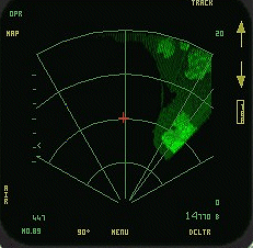 DI's FA18E Sea Surface Search - Sea Surface Search (SSS) is an extension of RBGM optimized for operation over water. It scans a large area to locate and acquire ships in cluttered seas. Range scales and azimuth sectors are similar to RBGM except that automatic thresholding produces a clutter-free display. Ground Moving Target [Indication] - Ground Moving Target Indication (GMTI) detects moving ground targets. GMTI normally functions as an activity indicator and as an aid in cueing sensor pods. In normal operation GMTI targets are alternately overlaid on the RBGM display on a frame-to-frame basis. It has range scales out to 40 NM and azimuth scan angles up to +45o.
 Jane's F/A 18 Doppler Beam Sharpening (EXP1) - Doppler Beam Sharpening (DBS) provides high resolution air-to-ground mapping. DBS Expand 1 improves azimuth angular resolution 19:1 with ground coverage over a 1.25 NM square patch. This mode enables rapid detection of tactical targets and provides much more finely detailed mapping than the GMTI overlay on RBGM. The tradeoff is a much smaller area of mapping. |
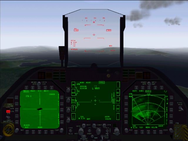
MISCELLANEOUS MODES Radar Elevation Up/Down - This refers to the potential articulation of your radar antenna, and hence scan, up/down in relation to the longitudinal axis of the aircraft. The "Band" in which your radar traverses may be elevated/decremented. This Band is delineated as "Bars" through which your radar scans and are indicated by 2B, 4B, and 6B. A 6B setting will scan a much taller vertical range of airspace with each horizontal cycle, but at the expense of update duration (less current information). To further comprehend this principle keep in mind that the radar scans left-right/top-bottom to fully annunciate on the DDI, much as a TV set's electron gun passes across the phosphor coating to fill the picture tube. Radar Azimuth Left/Right - Much like Radar Elevation but applied to the horizontal scanning capability of the radar. A 6B setting will scan a much wider horizontal range of airspace with each cycle. Again as Elevation, the tradeoff is timeliness of update for a larger volume of scanned airspace. At great distance to bogie this is probably a good investment, but close-in you need the fastest scan possible to properly evaluate the threat. Terrain Avoidance - Terrain Avoidance is used for all-weather low-altitude penetration and navigation. Hornet v3.0 does not fully model this capability however it is "built in" to autopilot when at very low altitude and utilizing Radar Altimeter. By the way, use of radar altimeter will not negate a 'stealthy' approach as it is a pulse device directed straight down from the belly of the aircraft. Only when banked at, or greater than, 90 degrees would it come into play as a detectable emission, but the interval is so short and randomly radiated that it is negligible to your tactical planning. Go to Page Four
|
|||
|
Copyright © 1997 - 2000 COMBATSIM.COM, INC. All Rights Reserved. Last Updated November 17th, 1998 |
||||